Download
Demo
- Overview
- Documents
User Rating: 1.7/5 ( 1 votes)
Your Rating:
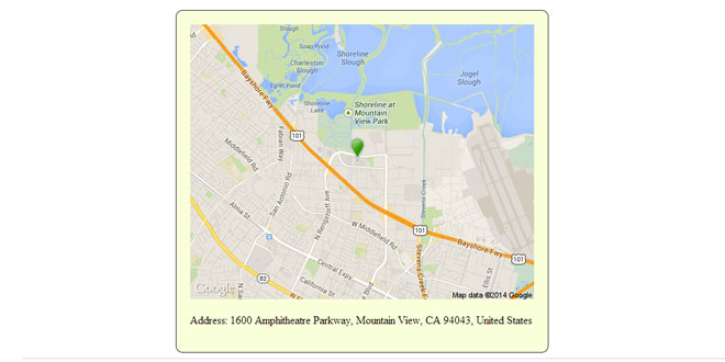
Static Google Maps is a very simple jQuery plugin for generating url for static google map and url for live map
Source: github.com
1. INCLUDE JS FILES
<script src="http://code.jquery.com/jquery-1.10.1.min.js"></script>
<script src="js/map.js"></script>
2. HTML
<a class="liveMap" target="_blank" href="#"><img id="staticMap" src="" alt=""/></a>
<p>Address: 1600 Amphitheatre Parkway, Mountain View, CA 94043, United States</p>
3. JAVASCRIPT
var url = $.staticMap({
    markerIcon: 'http://tinyurl.com/2ftvtt6',
    address: '1600 Amphitheatre Parkway, Mountain View, CA 94043, United States',
    width: 500,
    height:400,
    zoom: 13
});
$('#staticMap').attr('src', url);

var urlLive = $.liveMapLink({
	address: "1600 Amphitheatre Parkway, Mountain View, CA 94043, United States",
	zoom: 12
});
$('.liveMap').attr('href', urlLive);
- "$staticMap" plugin, generate a link to static google map.
- "$liveMapLink" plugin, generate a link to live google map.
4. OPTIONS
Options for Static maps
- key - The Static Maps API uses an API key to identify your application. Not required. 25 000 free static map requests per application per 24 hour period.
- zoom - Number: defines the zoom level of the map, which determines the magnification level of the map.
- width - Width of returned image
- height - Height of returned image
- address - Location address. Could be latitude, longitude ("123.34, 5.0453") or address.
- markerIcon - Url for custom marker icon
- sensor - true/false. (required) specifies whether the application requesting the static map is using a sensor to determine the user's location.
- mapType - defines the type of map to construct. There are several possible maptype values, including "roadmap", "satellite", "hybrid", and "terrain".
- scale - affects the number of pixels that are returned. "scale":2 returns twice as many pixels as "scale":1 while retaining the same coverage area and level of detail
- address - Location address. Could be latitude, longitude ("123.34, 5.0453") or address.
- zoom - Number: defines the zoom level of the map, which determines the magnification level of the map.
 JS Tutorial


