- Overview
- Documents
- Demos
gmaps.js allows you to use the potential of Google Maps in a simple way. No more extensive documentation or large amount of code.
Features include:
- Map events
- Geolocation
- Add Markers
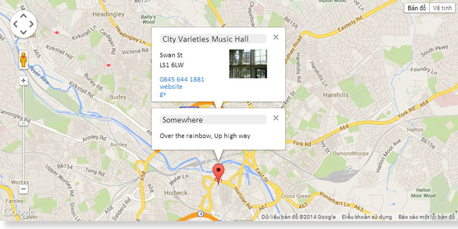
- Marker infoWindows
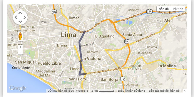
- Draw routes and circles
- Initial examples
- Context menu (for map and marker only)
- Geocoding
- Geofence
- Overlays
- Static maps
- Custom controls
- Fusion Tables
- KML and GeoRSS
- Elevation service
- Layers
- Map Types
- Overlay Map Types
- Add RadarSearch to the places layer
Using GMaps.js is as easy as:
new GMaps({
  div: '#map',
  lat: -12.043333,
  lng: -77.028333
});
You must define container ID, latitude andlongitude of the map's center.
You also can define zoom, width andheight. By default, zoom is 15. Width an height in a CSS class will replace these values.
Options:
div — HTMLDivElement
controls — Array
Collection of custom controls in the Map.
overlays — Array
layers — Array
singleLayers — Object
markers — Array
polylines — Array
routes — Array
polygons — Array
zoom — Integer
map — google.maps.Map
Native google.maps.Map object.
setContextMenu
Set a context menu for the entire Map or a marker.
setContextMenu accepts a hash of options.
Options:
| Name | Type | Description |
|---|---|---|
| control | string | Control that the context menu is attached. Can be map or marker. |
| options | array | Collection of context menu items. Each item in this collection has three options. |
Context menu item options:
| Name | Type | Description |
|---|---|---|
| title | string | Text displayed in the menu item. |
| name | string | Unique name used by GMaps to build the menu item. |
| action | function | Action performed when user selects a context menu item. It takes 1 parameter, which contains the coordinate in the map where the context menu is displayed. |
hideContextMenu
Hide current context menu displayed.
refresh
Trigger the resize event of a Map. Useful when the Map is created in a dynamic container
fitZoom
Fit zoom level to show all markers in the viewport.
fitBounds
Fit zoom level to show a bound of coordinates.
fitBounds accepts 1 parameter.
Parameters:
| Name | Type | Description |
|---|---|---|
| latLngs | array | Array of google.maps.LatLng objects. |
setCenter
Set center in the Map.
setCenter accepts 3 parameters.
Parameters:
| Name | Type | Description |
|---|---|---|
| lat | float | Latitude of the coordinate. |
| lng | float | Longitude of the coordinate. |
| callback | function | Function that triggers after the map is centered. |
getCenter
Get current coordinates of the center.
getDiv
Get div object described above.
setZoom
Set zoom level.
setZoom accepts 1 parameter.
Parameters:
| Name | Type | Description |
|---|---|---|
| value | integer | New zoom value. |
zoomIn
Increase zoom level.
zoomIn accepts 1 parameter.
Parameters:
| Name | Type | Description |
|---|---|---|
| value | integer | Number of zoom level that the zoom is increased. |
zoomOut
Decrease zoom level.
zoomOut accepts 1 parameter.
Parameters:
| Name | Type | Description |
|---|---|---|
| value | integer | Number of zoom level that the zoom is decreased. |
addControl
Add a control in the Map UI.
addControl accepts a hash of options.
Options:
| Name | Type | Description |
|---|---|---|
| content | string | HTML content for the control |
| id | string | ID of the DOM element |
| classes | string | List of CSS clases of the DOM element |
| position | string |
Position in the Map UI where the control is placed:
|
| style | object | Hash of CSS styles applied to the control. |
| events | object | Hash of events bound to the control. |
Control event options:
| Name | Type | Description |
|---|---|---|
| name | string | Name of the event. |
| event | function | Function attached to the event. |
createMarker
Create a marker and return it.
createMarker accepts a hash of options.
Options
| Name | Type | Description |
|---|---|---|
| lat | float | Latitude of the coordinate. |
| lng | float | Longitude of the coordinate. |
| details | object | Custom object with extra data. |
| fences | array | Collection of google.maps.Polygon objects. |
| outside | function | Callback fired when the marker is oustide any of its fences. |
| infoWindow | object | Object with all options defined in google.maps.InfoWindowOptions. |
Also, createMarker accepts any option defined in google.maps.MarkerOptions and any marker event defined in google.maps.Marker ('Events' section).
addMarker
Create a marker and add it in the Map and the markers collection.
addMarker accepts the same options of createMarker.
addMarkers
Add a collection of markers.
addMarkers accept one parameter, which is an array of the same options used in addMarker.
hideInfoWindows
Hide all infoWindows shown in the Map.
removeMarkers
Delete all markers and clear the markers collection.
drawOverlay
Draw a HTML overlay and add it in the Map.
drawOverlay accepts a hash of options.
Options
| Name | Type | Description |
|---|---|---|
| lat | float | Latitude of the coordinate where the overlay is placed. |
| lng | float | Longitude of the coordinate where the overlay is placed. |
| content | string | HTML that will be drawn in the overlay. |
| layer | string |
Id of any of the layers defined in google.maps.MapPanes:
|
| verticalAlign | string |
Vertical align of the overlay (where the center is the coordinate lat, lng):
|
| horizontalAlign | string |
Horizontal align of the overlay (where the center is the coordinate lat, lng):
|
| horizontalOffset | integer | Horizontal offset in pixels of the overlay. |
| verticalOffset | integer | Vertical offset in pixels of the overlay. |
removeOverlay
Delete a overlay.
removeOverlay accepts 1 parameter, which is a google.maps.OverlayView object.
removeOverlays
Delete all overlays.
drawPolyline
Draw a polyline and add it in the Map and the polylines collection.
drawPolyline accepts a hash of options.
Options
| Name | Type | Description |
|---|---|---|
| path | array | Collection of coordinates (which can be either an array [lat, lng] or a google.maps.LatLng object). |
| strokeColor | string | Color of the polyline. Can be hexadecimal or CSS name. |
| strokeOpacity | float | Opacity of the polyline from 0.0 to 1.0 |
| strokeWeight | integer | Polyline width in pixels. |
Also, drawPolyline accepts any event defined in google.maps.Polyline ('Events' section).
drawCircle
Draw a circle and add it in the Map.
drawCircle accepts a hash of options.
Options
| Name | Type | Description |
|---|---|---|
| lat | float | Latitude of the coordinate. |
| lng | float | Longitude of the coordinate. |
Also, drawCircle accepts any option defined in google.maps.CircleOptions and any event defined in google.maps.Circle ('Events' section).
drawRectangle
Draw a rectangle and add it in the Map.
drawRectangle accepts a hash of options.
Options
| Name | Type | Description |
|---|---|---|
| bounds | array | Bi-dimensional array of latitudes and longitudes |
Also, drawRectangle accepts any option defined in google.maps.RectangleOptions and any event defined in google.maps.Rectangle ('Events' section).
drawPolygon
Draw a polygon and add it in the Map and the polygons collection.
drawPolygon accepts a hash of options.
Options
| Name | Type | Description |
|---|---|---|
| paths | array | Bi-dimensional array of latitudes and longitudes |
Also, drawPolygon accepts any option defined in google.maps.PolygonOptions and any event defined in google.maps.Polygon ('Events' section).
loadFromFusionTables
Get data from a Fusion Tables table and create the layer in the Map.
loadFromFusionTables accepts a hash of options.
Options
| Name | Type | Description |
|---|---|---|
| events | object | Hash of events defined in google.maps.FusionTablesLayer ('Events' section). |
Also, loadFromFusionTables accepts any option defined in google.maps.FusionTablesLayerOptions.
loadFromKML
Get data from a KML file or a GeoRSS file and create the layer in the Map.
loadFromKML accepts a hash of options.
Options
| Name | Type | Description |
|---|---|---|
| url | string | URL of the source |
| events | object | Hash of events defined in google.maps.KmlLayer ('Events' section). |
Also, loadFromKML accepts any option defined in google.maps.KmlLayerOptions.
getRoutes
Get routes between two coordinates.
getRoutes accepts a hash of options.
Options
| Name | Type | Description |
|---|---|---|
| origin | array | Array with two elements: latitude and longitude |
| destination | array | Array with two elements: latitude and longitude |
| callback | function | Function that fires after the results are returned. |
Also, getRoutes accepts any option defined in google.maps.DirectionsRequest.
getElevations
Get elevation information of locations or routes.
getElevations accepts a hash of options.
Options
| Name | Type | Description |
|---|---|---|
| locations | array | Bi-dimensional array of latitudes and longitudes |
| path | boolean | If is true, makes a request along a path. If is false, only on discrete locations |
| callback | function | Native callback function defined in google.maps.ElevationService ('Methods' section) |
removePolylines
Delete all polylines.
drawRoute
Draw a route using polylines.
drawRoute accepts a hash of options.
Options
| Name | Type | Description |
|---|---|---|
| origin | array | Array with two elements: latitude and longitude |
| destination | array | Array with two elements: latitude and longitude |
| travelMode | string | Can be driving, bicycling or walking. |
| waypoints | array | Array of google.maps.DirectionsWaypoint objects. |
| strokeColor | string | Color of the polyline. Can be hexadecimal or CSS name. |
| strokeOpacity | float | Opacity of the polyline from 0.0 to 1.0 |
| strokeWeight | integer | Polyline width in pixels. |
cleanRoute
Alias for removePolylines.
travelRoute
Travel a route automatically.
travelRoute accepts a hash of options.
Options
| Name | Type | Description |
|---|---|---|
| origin | array | Array with two elements: latitude and longitude |
| destination | array | Array with two elements: latitude and longitude |
| travelMode | string | Can be driving, bicycling or walking. |
| waypoints | array | Array of google.maps.DirectionsWaypoint objects. |
| route | google.maps.DirectionsRoute | google.maps.DirectionsRoute object. |
| start | function | Fired before the first step. It pass a single parameter, which is a DirectionsRoute object. |
| step | function | Fired each step in the route. It pass 2 parameters, which is a DirectionsStep object and the total length of the steps. |
| end | function | Fired after the last step. It pass a single parameter, which is a DirectionsRoute object. |
drawSteppedRoute
Draw and travel a route automatically step by step.
drawSteppedRoute accepts a hash of options.
Options
| Name | Type | Description |
|---|---|---|
| origin | array | Array with two elements: latitude and longitude |
| destination | array | Array with two elements: latitude and longitude |
| travelMode | string | Can be driving, bicycling or walking. |
| waypoints | array | Array of google.maps.DirectionsWaypoint objects. |
| route | google.maps.DirectionsRoute | google.maps.DirectionsRoute object. |
| strokeColor | string | Color of the polyline. Can be hexadecimal or CSS name. |
| strokeOpacity | float | Opacity of the polyline from 0.0 to 1.0 |
| strokeWeight | integer | Polyline width in pixels. |
| start | function | Fired before the first step. It pass a single parameter, which is a DirectionsRoute object. |
| step | function | Fired each step in the route. It pass 2 parameters, which is a DirectionsStep object and the total length of the steps. |
| end | function | Fired after the last step. It pass a single parameter, which is a DirectionsRoute object. |
checkGeofence
Check if a coordinate is inside or outside of a geofence.
Use three arguments and return true or false depending if a coordinate is inside or outside a geofence.
Arguments
| Name | Type | Description |
|---|---|---|
| lat | float | Latitude of the coordinate |
| lng | float | Longitude of the coordinate |
| fence | google.maps.Polygon | Any polygon drawn in the map |
checkMarkerGeofence
Trigger a callback when a marker is outside its geofences.
Arguments
| Name | Type | Description |
|---|---|---|
| marker | google.maps.Marker | Marker created with addMarker. |
| outside_callback | function | Function that triggers at each marker fence (defined with fences option in addMarker). |
addLayer
Add a layer to the maps.
Arguments
| Name | Options | Description |
|---|---|---|
| LayerName | string | The name of the layer. e.g weather, clouds, transit, traffic, bicycling, panoramio, places |
| options | object |
An object with options for the layer. Places specific
|
removeLayer
Remove a layer from the maps.
Arguments
| Name | Options | Description |
|---|---|---|
| LayerName | string | The name of the layer. e.g weather, clouds, transit, traffic, bicycling, panoramio, places |
 JS Tutorial


